
Now available for iPad
QuextFlightNow on the App Store.
Plan smarter, brief clearly, and fly prepared.
7-day free trial on the monthly plan.

For eligible U.S. subscribers on the monthly plan. After 7 days, US$17.99/month, renewing automatically unless canceled. Cancel at least 24 hours before the trial ends to avoid a charge. One introductory offer per subscription group; Apple confirms eligibility. How to cancel.
A better briefing starts here
See the flight ahead before the engine starts.
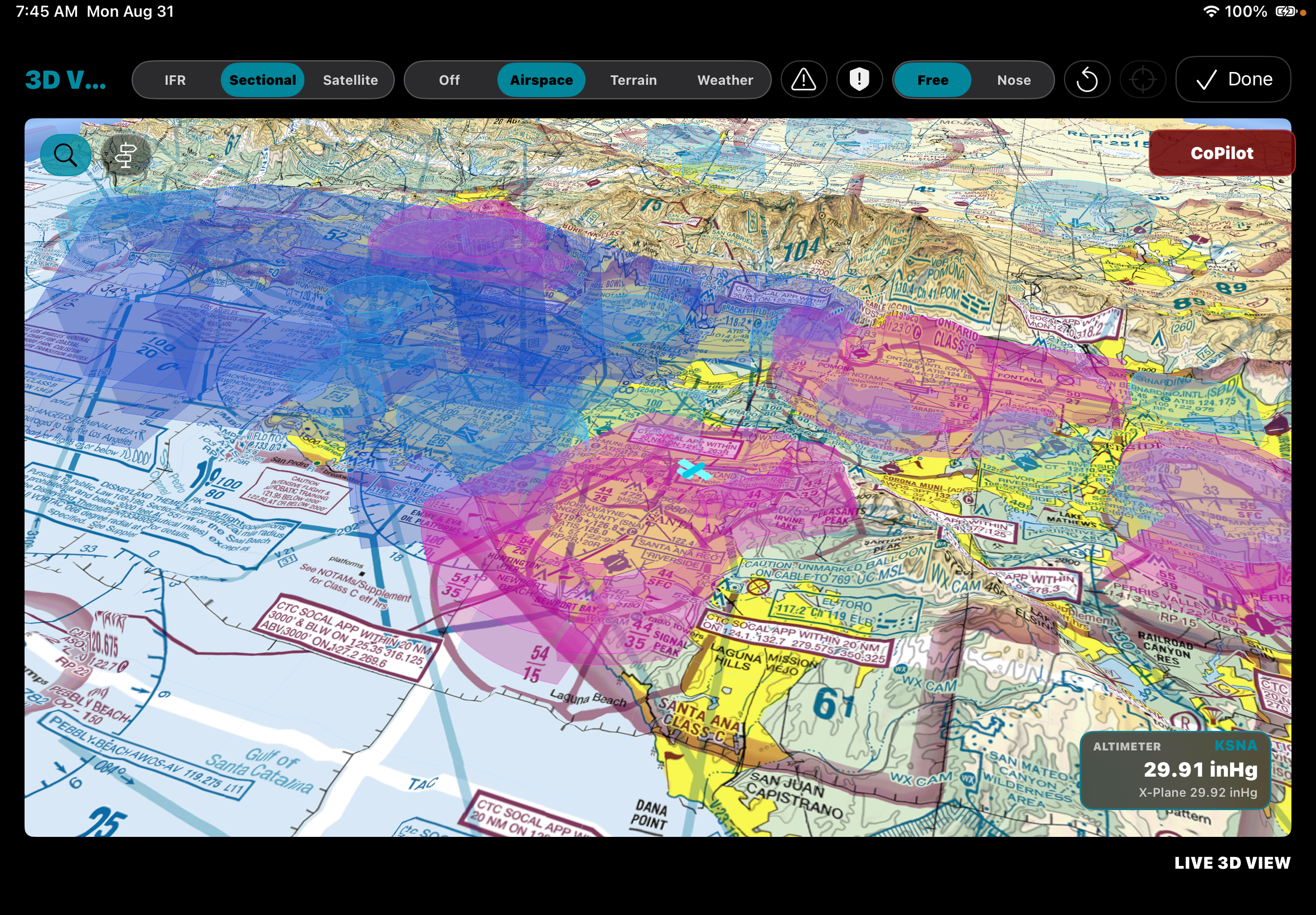
QuextFlight brings the information pilots work through before and during a flight into one focused iPad experience: route planning, charts, weather, terrain, airspace, airport detail, procedures, and NOTAMs.
Designed for single-pilot flow
Information at the moment it matters.
QuextFlight is designed around workload management: helping pilots move from planning to briefing to cockpit awareness without having to chase scattered information.
Especially in single-pilot operations, useful information needs to be timely, easy to understand, and available before it becomes a distraction. QuextFlight keeps route, weather, terrain, airspace, airport, procedure, and operational context close to the next decision.
Compare core capabilities
A different emphasis for the single-pilot cockpit.
Every EFB has a different approach. This high-level comparison focuses on published planning and awareness capabilities, plus the workflow each product emphasizes.
| Capability | QuextFlight | ForeFlight | Garmin Pilot |
|---|---|---|---|
| Flight planning, charts, weather, and airport information | Integrated planning and briefing flow | Available | Available |
| Offline content | Offline-first data packages for cockpit use | Downloadable charts and data | Downloadable charts and data |
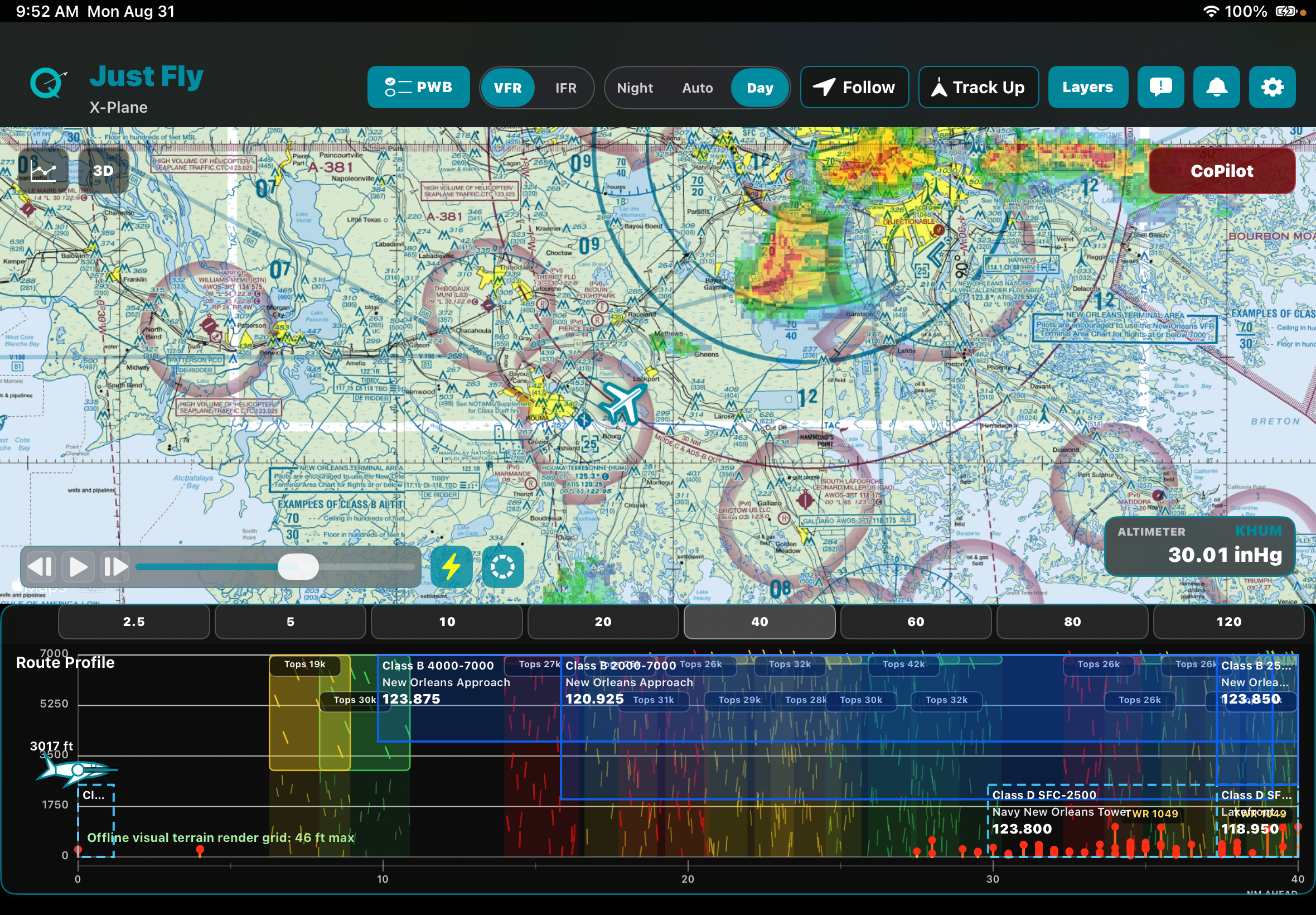
| Terrain, obstacle, airspace, and vertical route context | Route profile with integrated operational context | Profile and hazard-awareness tools* | Flight Profile and terrain/obstacle tools* |
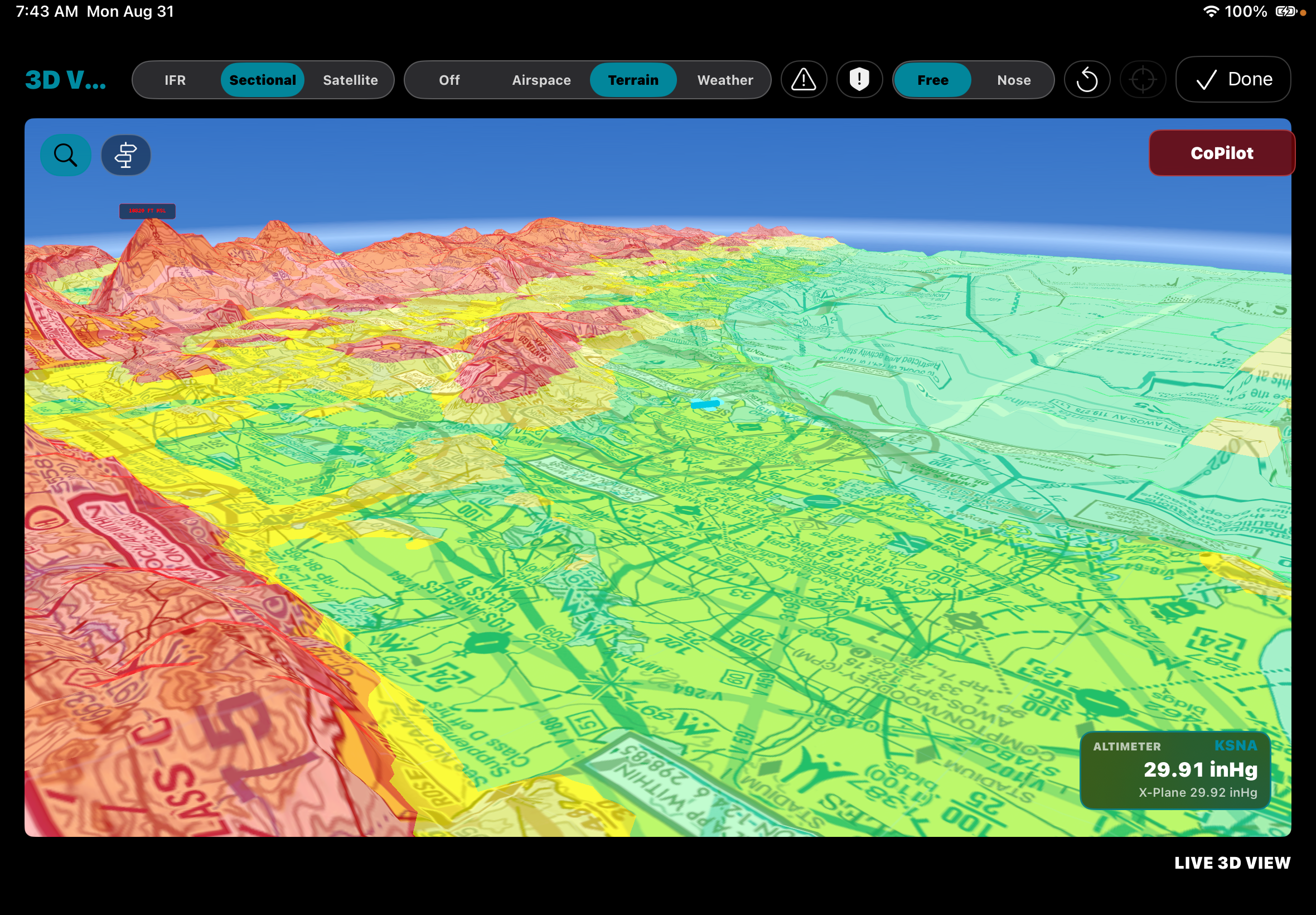
| 3D route or environment review | Interactive 3D route, airspace, terrain, and weather view with estimated IR-satellite cloud tops, airport signage, and wind arrows | 3D Preview and 3D Review* | Synthetic Vision* |
| Primary workflow emphasis | Timely, integrated information for single-pilot workload management | Broad, integrated electronic flight bag | Planning, navigation, and Garmin avionics integration |
*Capabilities, coverage, and availability vary by subscription plan, region, downloaded data, connected hardware, and device. Consult each provider's current product information before making a purchase decision. ForeFlight and Garmin Pilot are trademarks of their respective owners and are used here only to identify the products compared.
Route awareness
More than a line on a map.
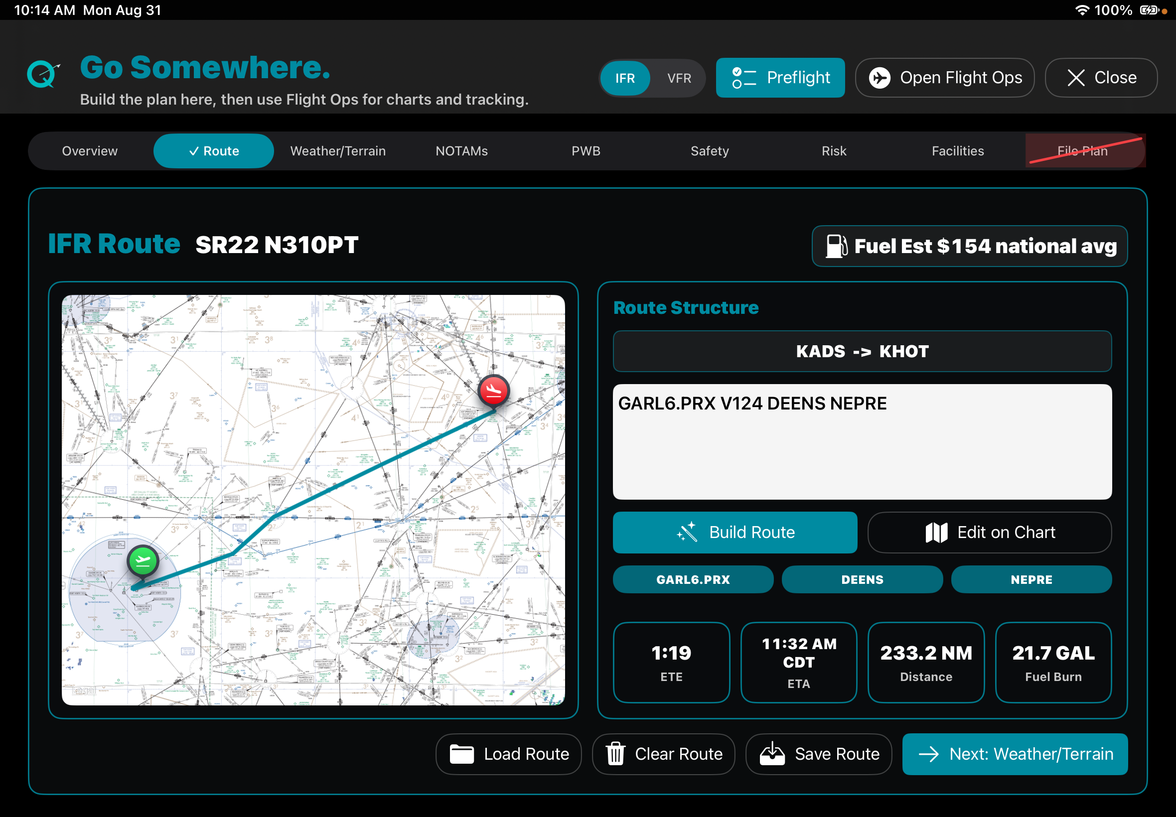
Build and review routes with distance, time, fuel, terrain, airspace, weather, and aircraft performance in view. Understand the implications of a route or altitude change before making the decision.
- Route planning with meaningful operational context
- Interactive 2D and 3D flight views
- Terrain, obstacle, and vertical profile awareness
Prepared in the cockpit
Turn a complicated briefing into a usable plan.
Review airport details, runway information, charts, procedures, approach minimums, and NOTAMs without losing the thread of the trip. QuextFlight keeps the relevant detail close to the decision.
- Airport and runway information in context
- Charts and procedures ready before departure
- Weather, airspace, and operational detail together
Built for the real cockpit
A closer look at QuextFlight.
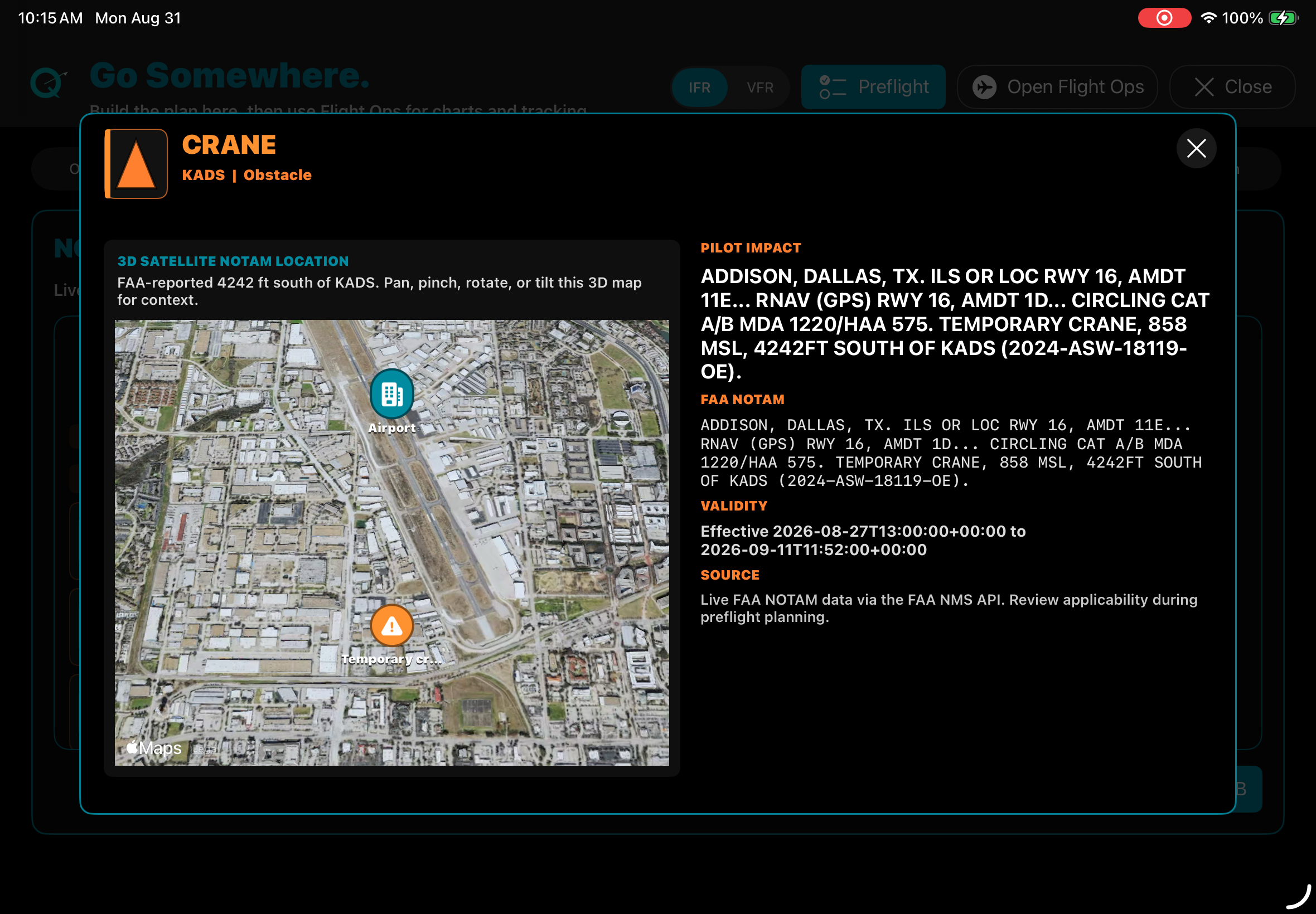
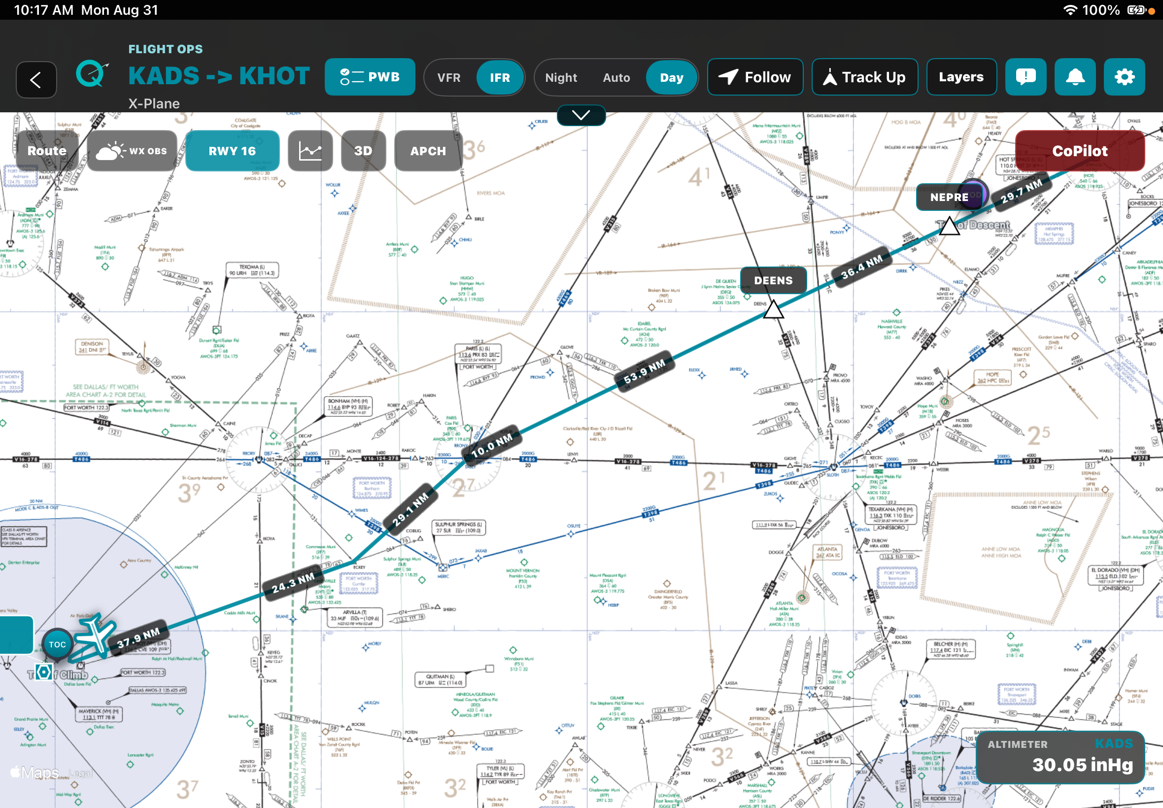
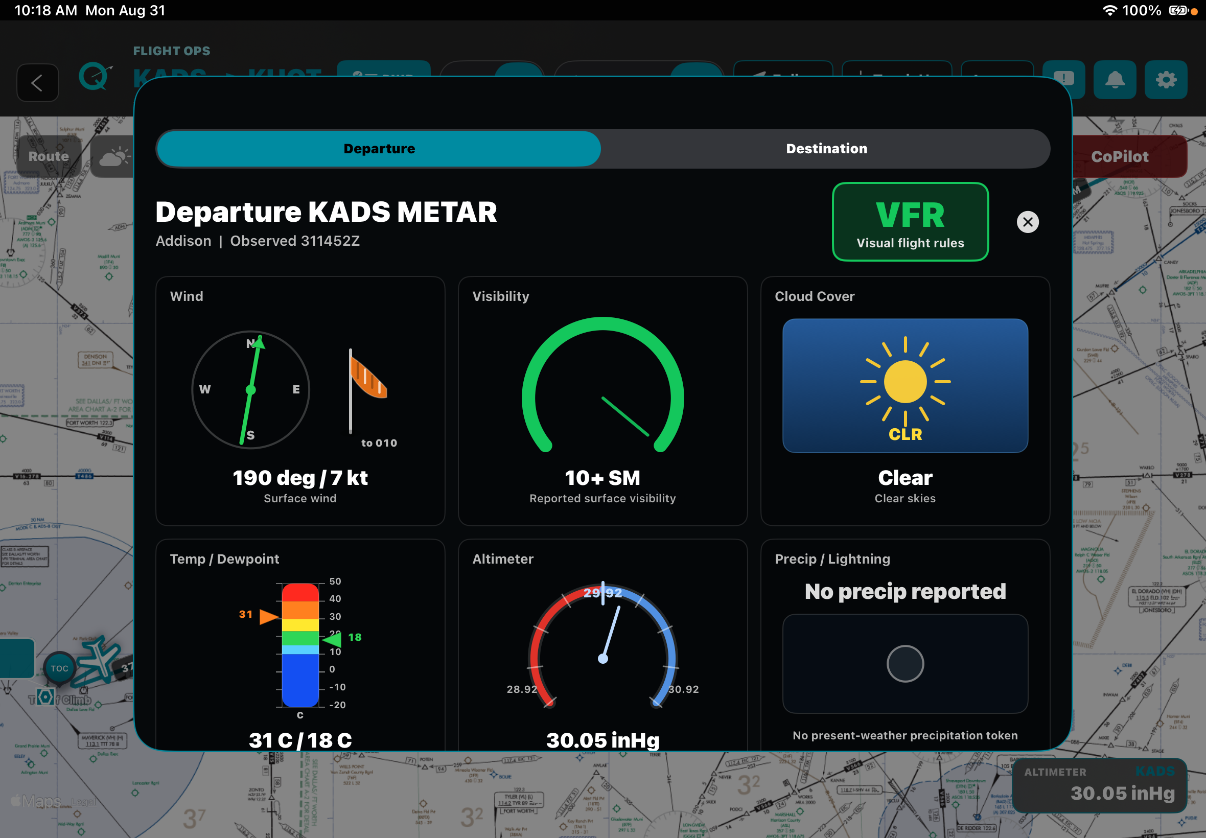
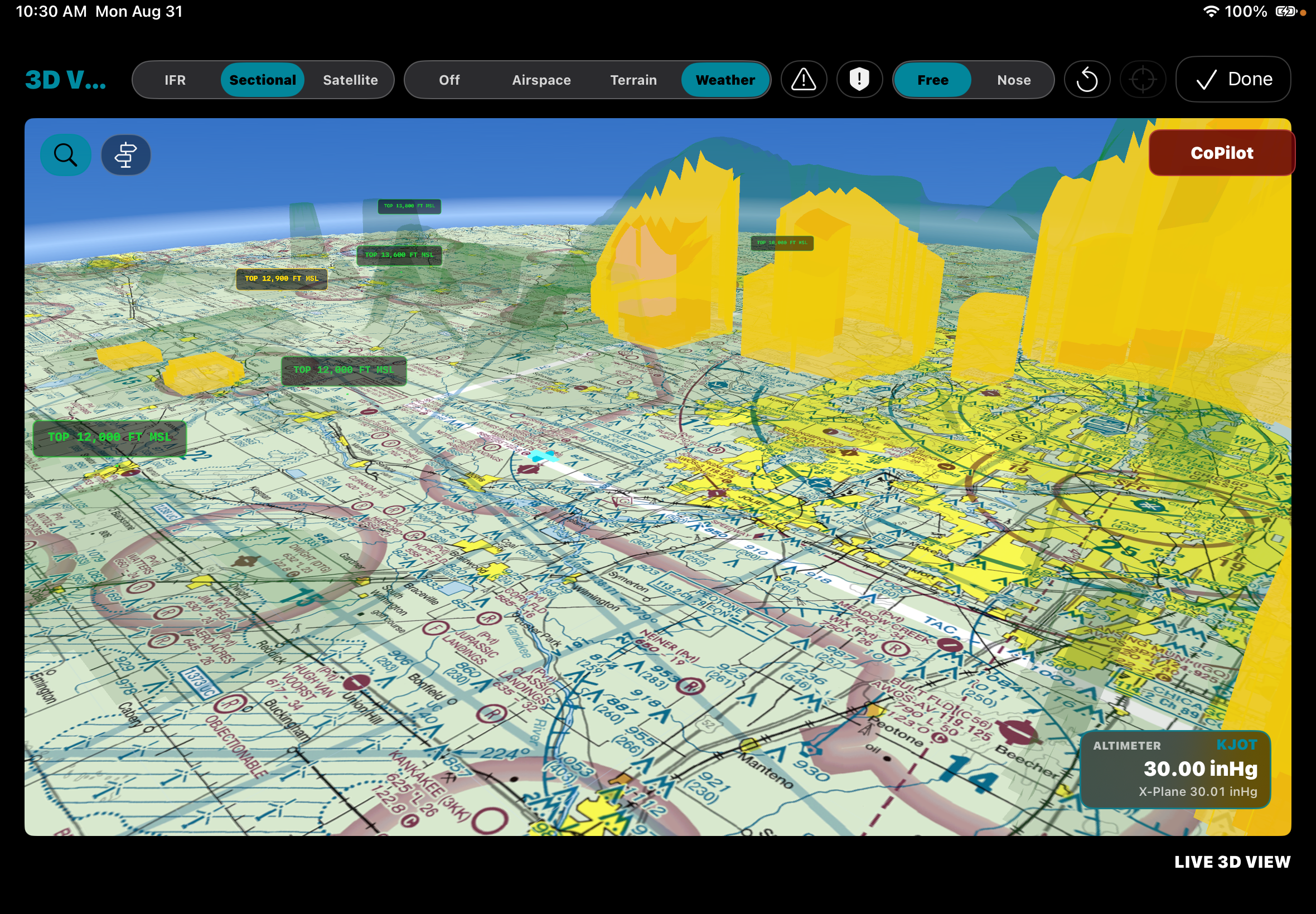
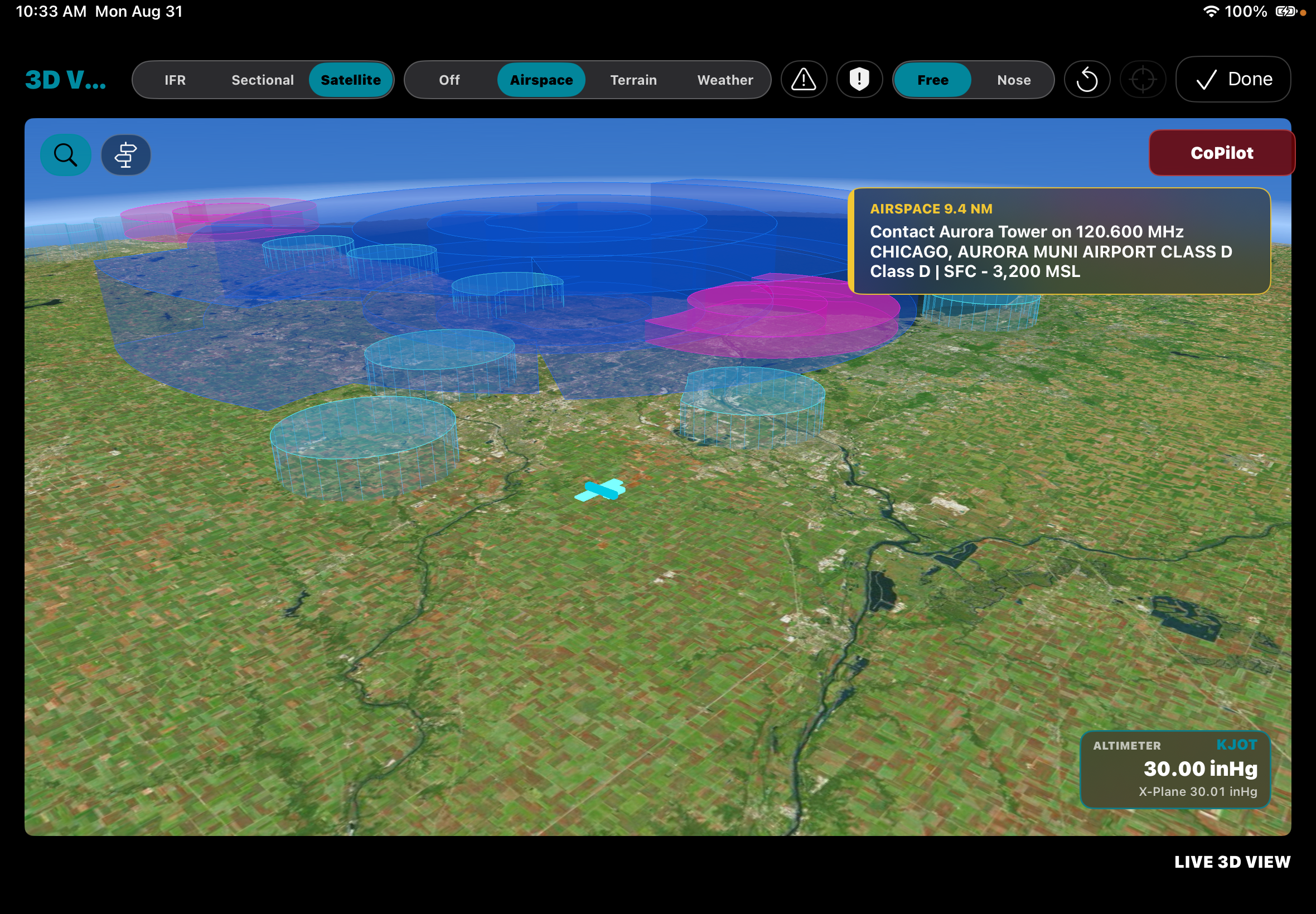
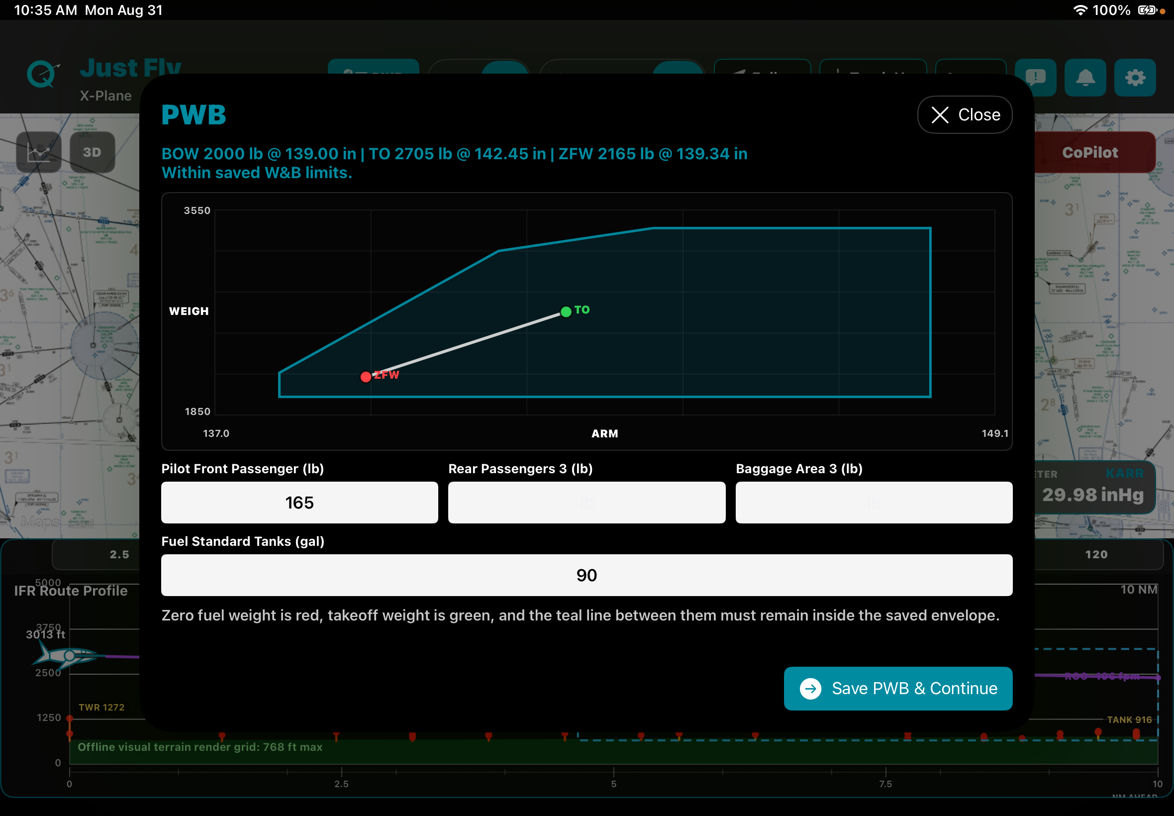
Offline-first
Prepare while connected. Keep flying when you are not.
Download the charts and data you need before departure, then continue flying with prepared information when connectivity is limited. QuextFlight is made for practical iPad use in preflight and in flight.
Coming soon
Android and iPhone GPS companions
Wi-Fi-only iPad? Use your phone’s GPS.
We’re developing native Android and iPhone companion apps to send your phone’s live GPS position and altitude directly to QuextFlight on iPad over Bluetooth Low Energy, after you explicitly pair the devices.
A Wi-Fi-only iPad, including iPad (A16), has no built-in GPS/GNSS receiver. The planned companion offers a way to use a compatible phone’s receiver without separate GPS hardware.
Read the companion FAQDesigned for Airplane Mode
The planned local GPS link is designed to work while your phone stays in Airplane Mode with cellular transmission disabled and Bluetooth enabled. It needs no internet connection, cellular service, hotspot, or cable. Your phone still needs a usable satellite GPS/GNSS fix.
Bluetooth use remains subject to applicable rules and aircraft operator or pilot-in-command instructions. Read the airborne use requirements.
Prepare your offline content
Download the maps, charts, and data you need before going offline. Current weather updates and other online features still need internet access.
Use compatible phone hardware
A phone with GPS/GNSS and Bluetooth Low Energy, the required location and Bluetooth permissions, and satellite reception is needed. The link cannot create a GPS fix on a phone without a receiver.
In development: Neither companion is available to download yet. Device compatibility and sustained Airplane Mode operation have not yet been verified. Background and locked-screen operation and reconnection are still to be tested. No release date is confirmed.